Due to obvious reasons this year the annual ESA Space App Camp went online!
Link:
ESA Press Release
ESA statement on the space app camp: ‘Using a virtual workspace, 20 app developers, machine learning and artificial intelligence experts will be tasked with devising innovative apps and feasible business models in one of six areas: food security, health, tourism, coastal monitoring, smart green cities, and agriculture – this last subject in honour of a former ESA employee Luigi Fusco.’
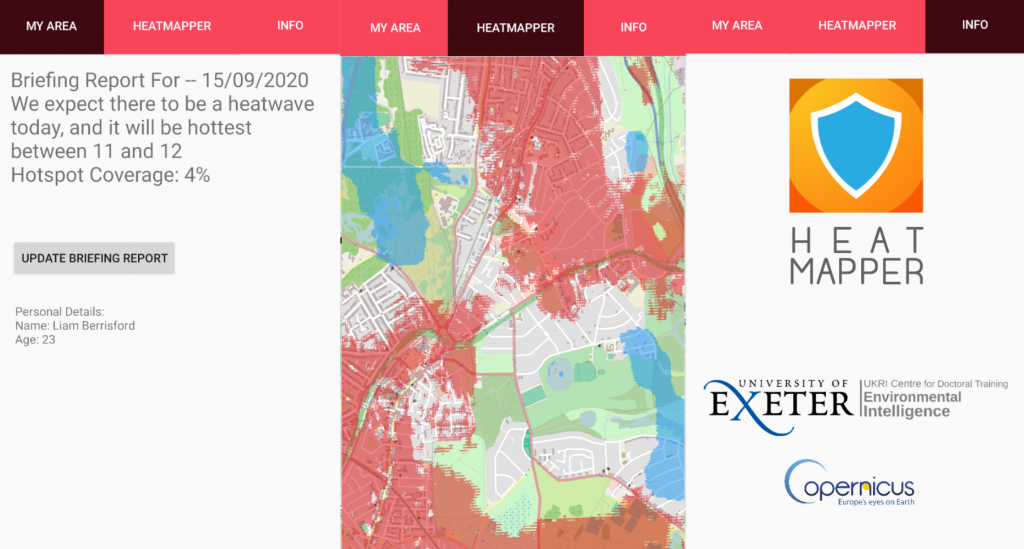
I partook in the Space Camp as part of Team Health where we tried to design and build an Android App that would use Earth Observation data from the ESA Copernicus programme to map out hot and cool spots within a city. The idea behind the app is that the user of the app can identify where in the city they should avoid but then also direct them to cool spots in the city where they will feel more comfortable during a heatwave.
An Image of the app that was developed for the Team Health challenge: